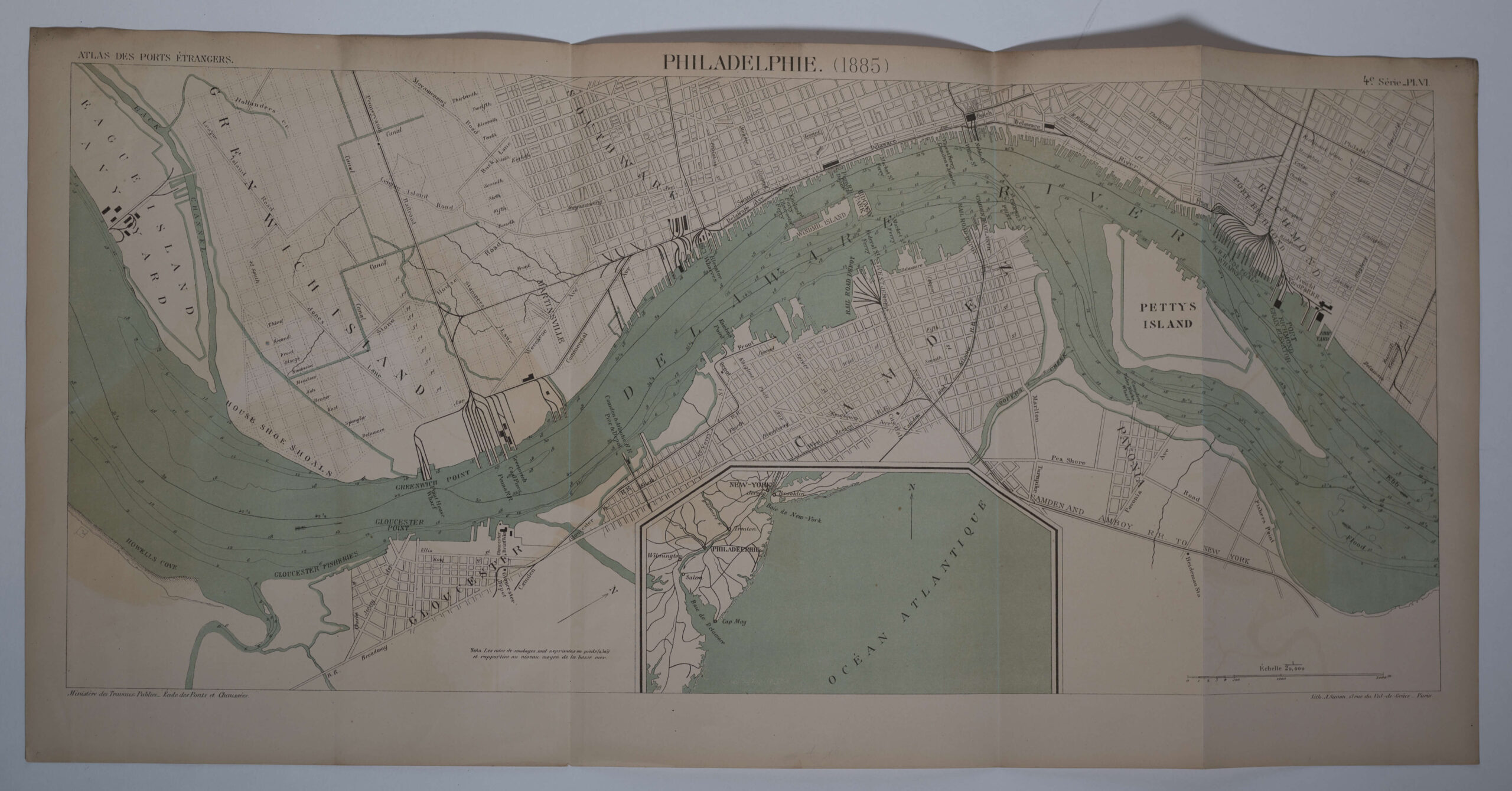

Philadelphia, in Pennsylvania, in 1885, uit ‘Atlas des Ports Étranges’ (1888)
Met inzetkaartje van de kust van New York tot aan Rehoboth Bay in Delaware
Uitgegeven door het Ministère des travaux publics, Direction des cartes, plans et archives et de la statistique graphique ; puis Ecole nationale des Ponts et Chaussées, Service des cartes et plans
De lithografie is gemaakt door A. Simon, in 13 Rue du Val-de-Grâce in Parijs.
Gedrukt door de Imprimerie Nationale in 1888
Tweekleuringe lithografie.
Schaal 1:20000
Schaalopgave met schaalstok in meters, rechtsonder in de kaart.
Boven, midden, in de kaartrand: PHILADELPHIE. (1885)
Boven, links, in de kaartand: ATLAS DES PORTS ÉTRANGEES.
Boven, rechts, in de kaartrand: 4.e Série_Pl. VI. (Vierde serie, Plan 6)
Links onder in de kaartrand: Ministère des Travaus Publics_ . Ecole des Ponts et Chaussées_.
Rechts onder in de kaartrand: Lith. A.Simon, 13 rue du Val-de-Grâce_Paris._ (Lith[ographie] A.Simon, 13 rue du Val-de-Grâce_Paris._)
Achterzijde: Pl. VI. / PHILADELPHIE. (opgeplakt label)
Afmetingen (breedte x hoogte in cm):
Blad: 67,7 x 33,2